
![]()
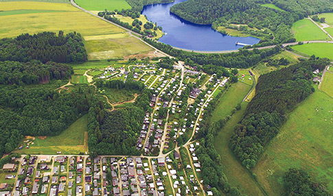
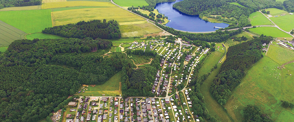
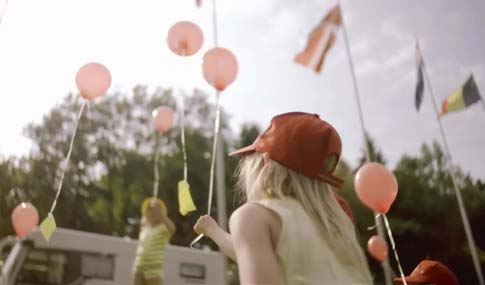
Campinganlage
mit modern, komfortabel ausgestatteten Plätzen für Kurz- und Dauercamper.
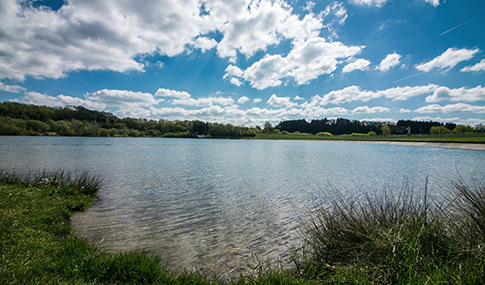
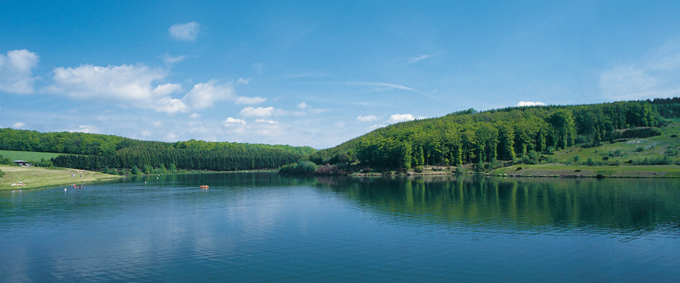
Am Ufer des Freilinger See
Betreiben Sie aktiv Wassersport oder genießen Sie einfach die Zeit am See.
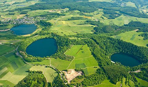
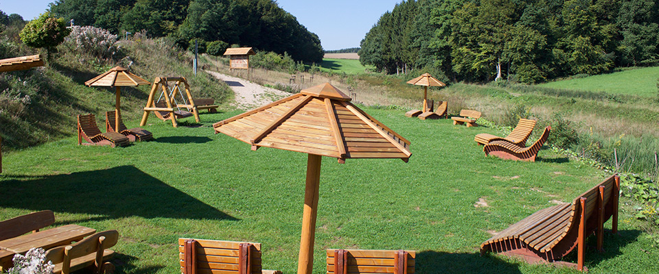
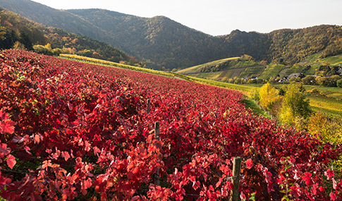
Sehenswerte Landschaft
Erleben Sie abwechslungsreiche Tage in der wunderschönen Region.

Du möchtest in einem persönlichen Arbeitsumfeld
im kleinen Team deine Ausbildung machen?
Du bist neugierig, kontaktfreudig und verantwortungsbewusst?
Na, dann schau dir das mal an…

Eifel-Camp Nachrichten
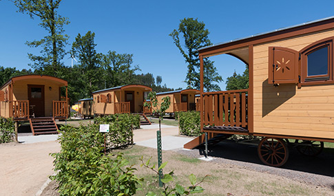
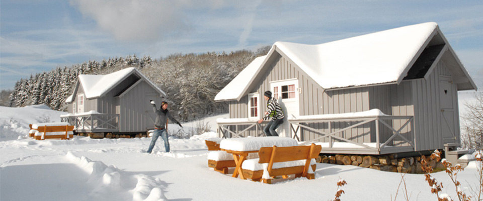
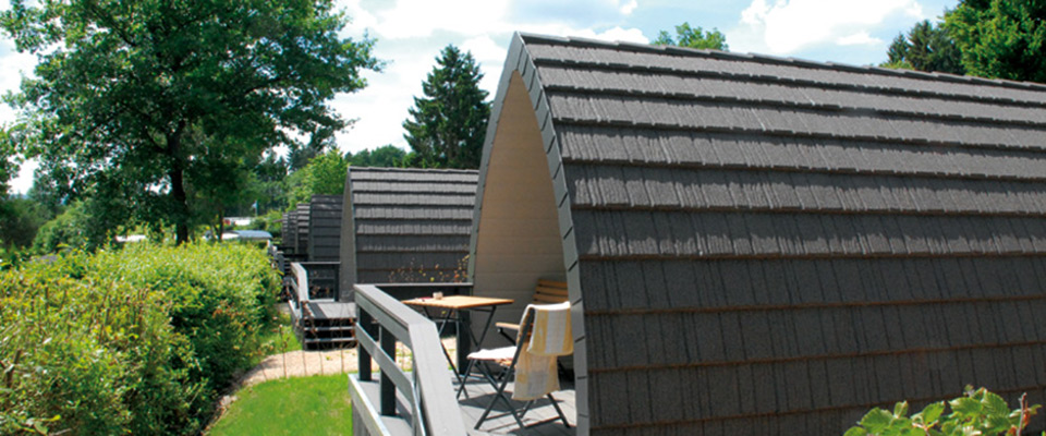
Naturwagen – das außergewöhnliche Naturerlebnis
Die Naturwagen sind die ideale Unterkunft für alle, die über keine Campingausrüstung verfügen, aber trotzdem gerne einen behaglichen Aufenthalt in der Natur verbringen möchten. Vor allem für Familien und Paare sind diese urgemütlichen Übernachtungsmöglichkeiten bestens geeignet.
weiterlesen…
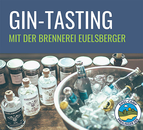
 GIN-TASTING im Eifel-Camp – 18.05.2024 ab 18 Uhr
Dauer: 2 Stunden | Treffpunkt: Geißbockstadl
Im Tasting verkosten Sie 5 verschiedene EUELSBERGER GINS, pur und mit dem passendenTonic. Brennmeister Stephan führt durch die Aromenwelt von EUELSBERGER, erzählt seinen ersten Ideen, der Entstehung und Entwicklung Euelsberger, erklärt den Produktionsprozess und geht auf Ihre Fragen ein.
Mindestteilnehmerzahl: 20 Personen. Wir bitten um vorherige Anmeldung an der Rezeption.
Für die Verkostung ist eine Teilnahmegebühr in Höhe von 28,00 € zu entrichten.
weitere Informationen…
Vorteilsangebote
Neben unseren bekannten Dauerbrennern, wie dem „Osterangebot“ und dem „Weihnachts- und Silvesterangebot“ haben wir auch zwei neue Angebote im Spätsommer und Herbst!
Entdecken Sie hier Ihr passendes Angebot!
weiterlesen…

Brötchenservice
Beginnen Sie den Tag mit frischen, leckeren Brötchen.
Unseren Gästen bieten wir die Möglichkeit, online Brötchen zu bestellen. Die Bestellungen sind ab dem Anreisetag nach dem Check-In möglich. Bitte geben Sie die bei der Buchung verwendete bzw. in unserem System hinterlegte E-Mail-Adresse an.
zur Bestellung…
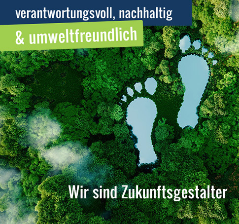
Guter Urlaub mit Nachhaltigkeit
Im Eifel-Camp – Freilinger See sind wir ein Teil der großen Freizeit-Oasen Familie.
Diese inspiriert uns täglich, unseren Gästen einen schönen Aufenthalt zu ermöglichen und Positives für unsere Umwelt zu tun.
Wir sind Zukunftsgestalter, planen und handeln nachhaltig. Stetig arbeiten wir daran, unseren ökologischen Fußabdruck zu verringern.
Viele Projekte haben wir bereits umgesetzt, die unseren Gästen einen noch komfortableren Aufenthalt bieten und gleichzeitig ökologisch wertvoll sind.
Einige Beispiele…
![]()
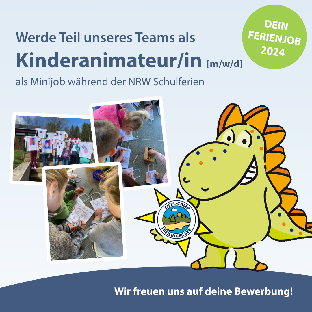
Kinderanimateur/in (m/w/d) für die NRW-Ferienzeiten
Du kannst dich und andere begeistern und bist motiviert in den Ferien unseren kleinen Gästen unvergessliche Ferienmomente zu bereiten?
Für unsere Kinderanimation im Eifel-Camp, einem 5 Sterne Superior Campingplatz, suchen wir für die NRW-Ferienzeiten (Ostern, Sommer und Herbst) eine/n motivierte/n und begeisterte/n Kinderanimateur/in.
Bewirb dich unkompliziert mit einer kurzen E-Mail, in der du dich vorstellst.
weiterlesen…
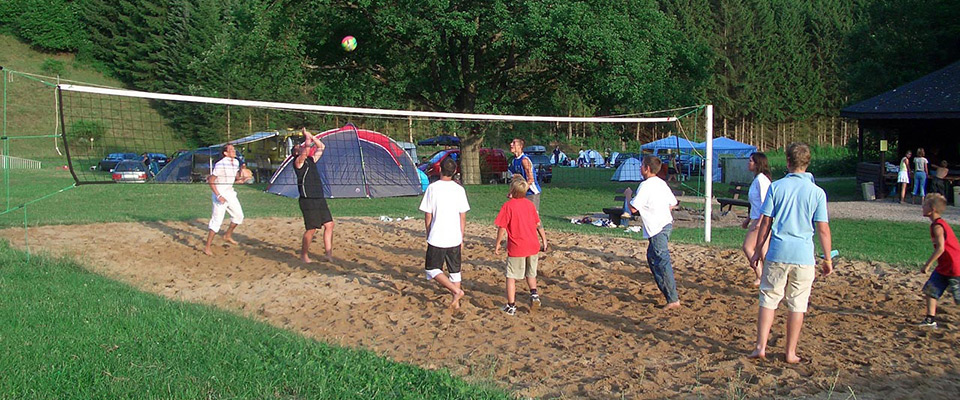
Veranstaltungen & Freizeit-Animation
In den NRW Ferienzeiten sowie an einigen langen Wochenenden bieten wir ein sehr abwechslungsreiches Animations-, Sport- und Unterhaltungsprogramm für Kinder, Jugendliche, Familien, Erwachsene und Senioren an.
zum Terminkalender…
Parken mit System
Vor dem Eifel-Camp und am Freilinger See befinden sich zwei mit digitalem Parksystem ausgestattete Parkflächen. Dieses erfasst automatisch die KFZ-Kennzeichen und berechnet das Parkentgelt. Bezahlt werden kann bequem per App oder am Kassenautomaten.
Weitere Informationen zum Parksystem…
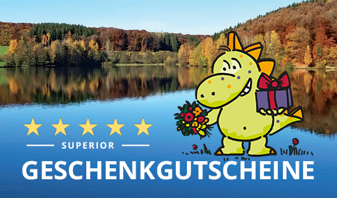
Geschenkgutscheine
Machen Sie Ihren Liebsten eine Freude – mit einem Geschenkgutschein des Eifel-Camps!
Verschenken Sie das Wertvollste, das es gibt: Freizeit! Ob als Dankeschön, zum Geburtstag oder zu Festtagen mit einem Gutschein vom Eifel-Camp verschenken Sie etwas ganz Besonderes. Der Gutschein kann im Eifel-Camp für einen Campingurlaub auf einem der verschiedenen Stellplätze verwendet werden, ebenso wie für einen Aufenthalt in einem unserer Mietobjekte.
zur Bestellung…
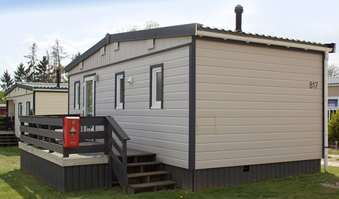
Gebrauchte Mobilheime
Genießen Sie Ihre Freizeit ganzjährig im Eifel-Camp und erwerben Sie günstig ein gebrauchtes Mobilheim.
Die Ruhe, die Natur, die nette Nachbarschaft, das gute Freizeitangebot und die überschaubaren Kosten sind einfach überzeugend.
zur Verkaufsliste…
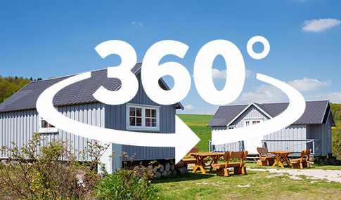
360 Grad Panoramen
Neue Panoramabilder und virtuelle Rundgänge vermitteln Ihnen sehr gute räumliche Impressionen unserer schönen Platzanlage.
Schauen Sie sich doch mal um!
weiterlesen…
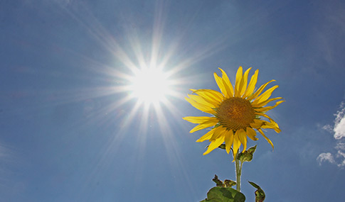
Schönwettergarantie – wo gibt’s denn sowas?
Wenn Ihnen das Wetter nicht zusagt, können Sie im Eifel-Camp den fest reservierten Stellplatz oder die Unterkunft vorzeitig verlassen – egal aus welchem Grund. Der anteilige Restwert verfällt nicht.
Innerhalb eines Jahres können Sie Ihren Urlaub dann unter voller Anrechnung des Restwertes fortsetzen. Zusätzliche Reservierungsgebühren fallen nicht an.
Dies gilt für Buchungen mit mindestens 4 Nächten.
Wir schenken Ihnen die Bettensteuer
Die gute Nachricht:
Wir haben uns dazu entschlossen, Ihnen diese nicht zusätzlich zu berechnen.